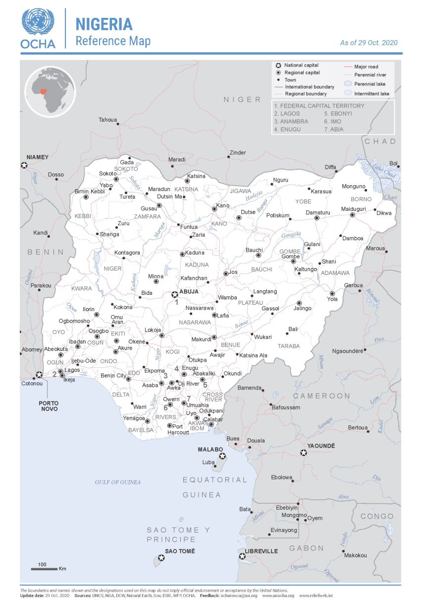
Home COI Report - Nigeria: Security Situation Map Table of contents Table of Contents Acknowledgements Disclaimer Glossary and abbreviations Introduction Methodology Defining the terms of reference Collecting information Quality control Sources Sources on security incidents and fatalities Structure and use of the report Terminology and classification of actors Map 1. General description of the security situation 1.1. Main Actors 1.1.1. State armed actors 1.1.2. Vigilante groups and other communal defence forces 1.1.3. Non-state armed actors 1.2. Conflict drivers and security trends 1.2.1. Attacks by Islamist groups and counter-insurgency operations 1.2.2. Intercommunal conflicts, including between farmers and herders 1.2.3. Banditry and kidnappings 1.2.4. Violence linked to criminality, gangs/cults and separatism in the Niger Delta 1.2.5. Electoral violence 1.2.6. Improvised explosive devices (IEDs) and airstrikes 1.2.7. Main security trends and impact on the civilian population 2. Security situation per state and Federal Capital Territory 2.1 North-Central 2.1.1. Benue 2.1.2. FCT Abuja 2.1.3. Kogi 2.1.4. Kwara 2.1.5. Nasarawa 2.1.6. Niger 2.1.7. Plateau 2.2. North-East 2.2.1. Adamawa 2.2.2. Bauchi 2.2.3. Borno 2.2.4. Gombe 2.2.5. Taraba 2.2.6. Yobe 2.3. North-West 2.3.1. Jigawa 2.3.2. Kaduna 2.3.3. Kano 2.3.4 Katsina 2.3.5. Kebbi 2.3.6. Sokoto 2.3.7. Zamfara 2.4. South-East 2.4.1. Abia 2.4.2. Anambra 2.4.3. Ebonyi 2.4.4. Enugu 2.4.5. Imo 2.5. South-South 2.5.1. Akwa Ibom 2.5.2. Bayelsa 2.5.3. Cross River 2.5.4. Delta 2.5.5. Edo 2.5.6. Rivers 2.6. South-West 2.6.1. Ekiti 2.6.2. Ogun 2.6.3. Ondo 2.6.4 Osun 2.6.5. Oyo 2.6.6. Lagos Annex 1: Bibliography Oral sources, including anonymous sources Public sources Annex 2: Terms of Reference Security situation Citation Please cite as: EUAA, 'Map' in COI Report - Nigeria: Security Situation, January 2026. Copy Print Map Map . Nigeria UNOCHA15 15 UNOCHA, Nigeria: Reference Map, 29 October 2020, url Book traversal links for COI Report - Nigeria: Security Situation Previous Parent Next